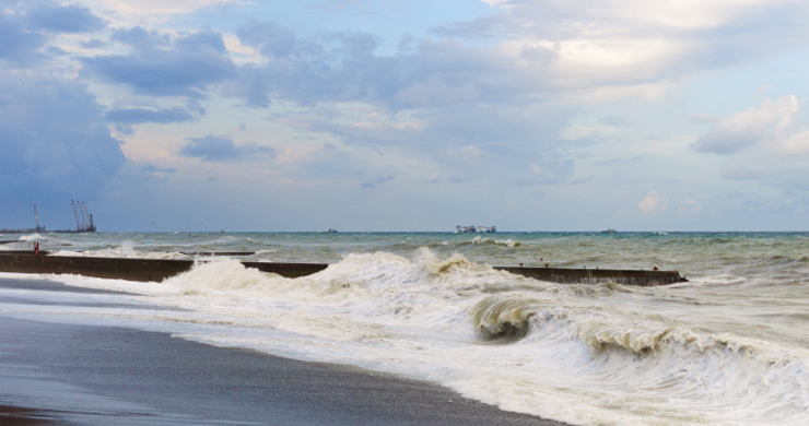
Why Is The Risk Of Coastal Flooding Increasing?
In the first part of the report for the Welsh Government report it highlights a number of reasons why the risk of coastal flooding is increasing. We are going to look at what it says and then work out what it means.
Quote 1
“Projections for the future of our coastal areas are of increasing risk, as a consequence of climate change and in particular sea level rise.”
- The word projections in this quote refers to predictions of what might happen in the future. These predictions are based on large computer models which run millions of calculations using all available data along with the variable nature of our global climate. Each time the model gets slightly different results but we can see what is most likely.
- The future of our coastal areas are of increasing risk is much easier to understand that there is an increasing risk or an increased chance (in this case of flooding) to our coastal areas.
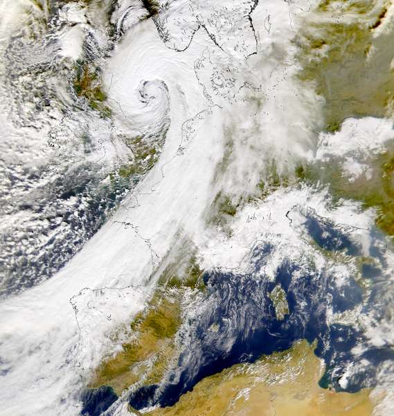
- As a consequence of climate change and in particular sea level rise means that the increased risk of flooding already identified is due to changes to our global climate (which is getting warmer). The most important part of this in relation to flooding is rising sea levels; however this is not the only factor with increasing numbers of storms also being important as well as the fact that there is also an increased risk of more severe or stronger storms.
Quote 2
“The Intergovernmental Panel on Climate Change (IPCC), Fifth Assessment Report estimates that global temperatures have risen 0.85°C from 1880-2012. There has been an associated rise in global sea level which is now increasing at approximately 3.2 mm per year. The IPCC state that it is very likely that the 21st Century sea level rise rate will exceed the 1971-2000 rate, for all modelled emissions scenarios.“
- The Intergovernmental Panel on Climate Change (IPCC), Fifth Assessment Report is all about a scientific research group set up by the United Nations to look at all the evidence about climate change; for short we call it the IPPC.
- The IPPC writes regular reports the information comes from the most recent report which was the fifth report written.
- The IPPC state that between 1880 and 2012 average temperatures around the world have increased by 0.85°C.
- All of the models predict that the rates of increase will be bigger in the future; so will be more than 3.2mm each year.
- This rise in temperature causes sea levels to increase by 3.2mm each year.
Quote 3
“A central estimate of 0.47m increase is projected by 2081-2100, relative to the 1986-2005 baseline. An increase of 0.5m is estimated to result in 10-fold to 100-fold increase in the frequency of sea level extremes (relative to present day) in northern Europe by the end of the century. This would mean a coastal flooding event that has a return period of 100 years at present will potentially occur on average between every year and every ten years by 2100.”
- The central estimate is the most likely to occur, it is in the middle between the highest predicted by models and the lowest.
- By the end of this century this central estimate is that sea levels will have increased by 0.47 (nearly half (0.5) a metre) from the levels measured (average of all measurements) between 1986 and 2005.
- This means that sea level extreme events that at the moment happen on average only once every 100 years will happen on average once every 1 – 10 years.
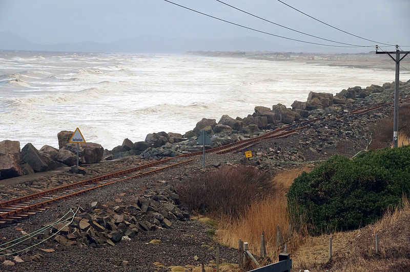
Photo by Oosoom used under CC BY
This photo shows the railway at Llanaber near Barmouth which was damaged and nearly washed away in the 2014 storm event, could this happen every year?
Quote 4
“Storminess and precipitation extremes are also important factors that will be exacerbated by climate change and contribute to the increased flood and erosion risk. Already, the Met Office have recorded an increase in days of heavy rain in the UK, such that a rain event with an average return period of 125 days in the 1970's now has a return period of 85 days.”
© NASA
- Storms and precipitation (all moisture coming from the atmosphere to be deposited on the planet surface) extremes (these are the biggest events) will be exacerbated which means made worse by climate change.
- This will make chances of flooding or coastal erosion happening higher.
- The Met Office or to give it its full name the Meteorological Office is the government agency that researches weather and climate and also produces forecasts.
- There have been more days with heavy rain each year.
- Big events that used to happen on average every 125 days in the 1970’s now happen every 85 days this is an increase of around one third.
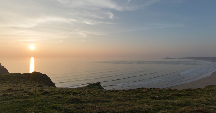
Quote 5
“In terms of storminess the Met Office suggests that while there have been no significant changes in storm frequency in mid latitudes in the north Atlantic, the intensity of individual storms has increased.”
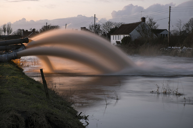
Photo from Geograph Project by Noel Jenkins used under CC BY
- The Met Office has not found proof that there are more storms each year.
- However it has found that the storms are stronger.
Quote 6
“It is important to recognise that the fundamental physics of global warming provides certainty that continuing (and historical) emissions will lead to further warming of both the atmosphere and consequently the oceans, making further significant sea level rise due to thermal expansion inevitable. Moreover in south and mid-Wales isostatic land subsidence will inevitably exacerbate sea level rise too.”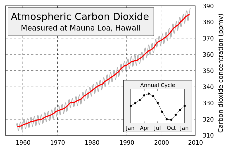
Photo from NOAA published data by Robert A. Rohde used under CC-NC-SA
- The world is controlled by physics.
- Physics tells us that gas emissions (or gas release into the air) such as CO2 in the past and now will lead to more warming of the air (atmosphere) and oceans.
- Thermal expansion is what happens when things get warmer – they get bigger. As these seas get warmer they will increase in volume and sea level will rise. When sea levels change as a result in changes of the volume of water this is called eustatic change.
- Isostatic land subsidence means that the land surface also goes up and down – this is called isostatic change. In Wales and the United Kingdom this is nearly entirely due to the weight of ice that was on the Northern half of the country during a period called the last ice age. This ice which at its thickest was approaching 1000 metres weighed down the North where it was colder and had more mountains. The United Kingdom was like a giant seesaw with the North pushed down and the South raised up. Over the past 10,000-20,000 years since the ice melted the seesaw is slowly moving back to ‘level’ this means the South is now slowly sinking while the North is slowly rebounding.
- In South Wales and even Mid-Wales the coast is actually sinking slightly which will make rising sea waters even worse.
Final Thoughts
If all of this was not enough; the sea level is rising, the land is sinking, storms are getting stronger which bring more rain, strong winds which cause high waves there is something else that we have not explained yet; the storm surge. A storm is an area of low air pressure, this means that air is rising so is not pressing down on the earth or ocean surface with as much force as usual. The stronger the storm then the lower the air pressure. High air pressure pushes down on the surface and over the oceans and seas this lowers the sea level. Under low air pressure the sea level goes up and under the very low air pressure of a big storm this can increase sea levels significantly.
We had bad storms in 2013 and 2014 but we did not have a big storm, hit with a big storm surge exactly on a very high tide such as the supertides of spring 2015. If this were to happen we would be in a lot of trouble. The problem is this is getting more likely every year.
Discussion Question
How does the land of the United Kingdom act like a giant seesaw?
A popular myth is that the polar ice caps will melt and this will cause sea levels to rise. Why is this a myth?
Ice that makes up the Arctic ice cap is floating; it already takes up its own volume by displacement of the surrounding sea water. Displacement is what you see when you get into a bath and the water level goes up.
The Antarctic ice cap is on land/a continent but it is actually appearing to be accumulating more ice and snow. This is because even in the warmest seasons the temperature rarely increases above minus 10 degrees Celsius so even with one or even two degrees Celsius warming there will be significant chance for melting. The warmer ocean surrounding the Antarctic will have higher levels of evaporation and some of this extra moisture will travel across the Antarctic ice cap to be precipitated as extra snow.
Where ice which is currently on land melts in large volumes such as Greenland it will cause a eustatic change in sea levels. Can you identify other areas of land near or in the Arctic region or high mountains where this might occur using a map?
Student Activity
Try to write a list with 10 reasons why you thing coastal flooding might be getting worse.
Extension Activity
Try to explain why each of your 10 reasons might make coastal flooding worse.