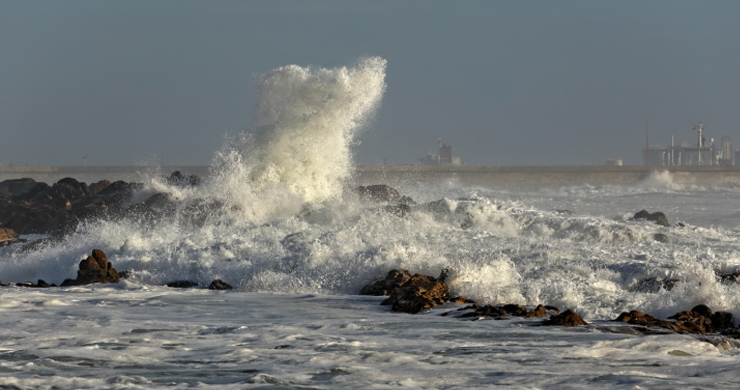
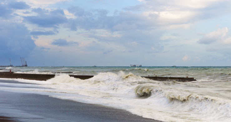
What Will We Do About Coastal Flooding?
Decision Making Exercise
Imagine you have been given a job in the Wales Coastal Monitoring Centre – W.C.M.C.
You will be asked to write a brief report about a part of the coast in Wales.
You will need to:
- Write some information about the coastal floods in 2013 and 2014.
- Use some of the information from the main article to say why floods might get worse along our coastlines.
- What do the following terms mean:
- No Active Intervention (N.A.I.)
- Hold the Line (H.T.L.)
- Managed Realignment (M.R.)
- Advance the Line (A.T.L.)
- Use maps to help you to show what has been planned for a place along our coastline in the following time periods:
- Epoch 1 (short-term) = years 0 to 20
- Epoch 2 (medium term) = years 20 to 50 and
- Epoch 3 (long term) = years 50 to 100
- Your Decision:
- Either justify why you think this is the best option or
- Provide an alternative plan and justify why you have changed it.
- Extension
- Choose more locations to explore different options of managing our coast against future floods.
Shoreline Management Plans
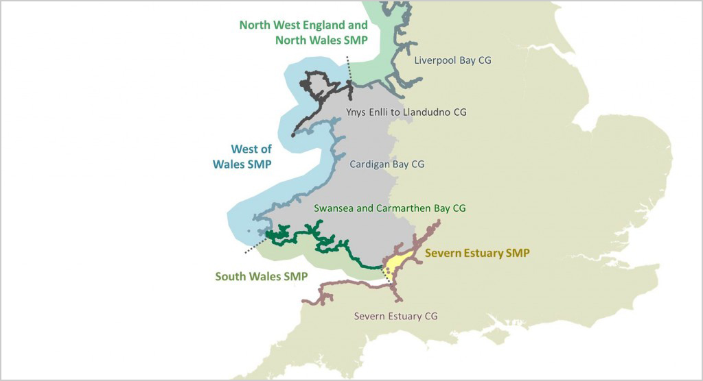
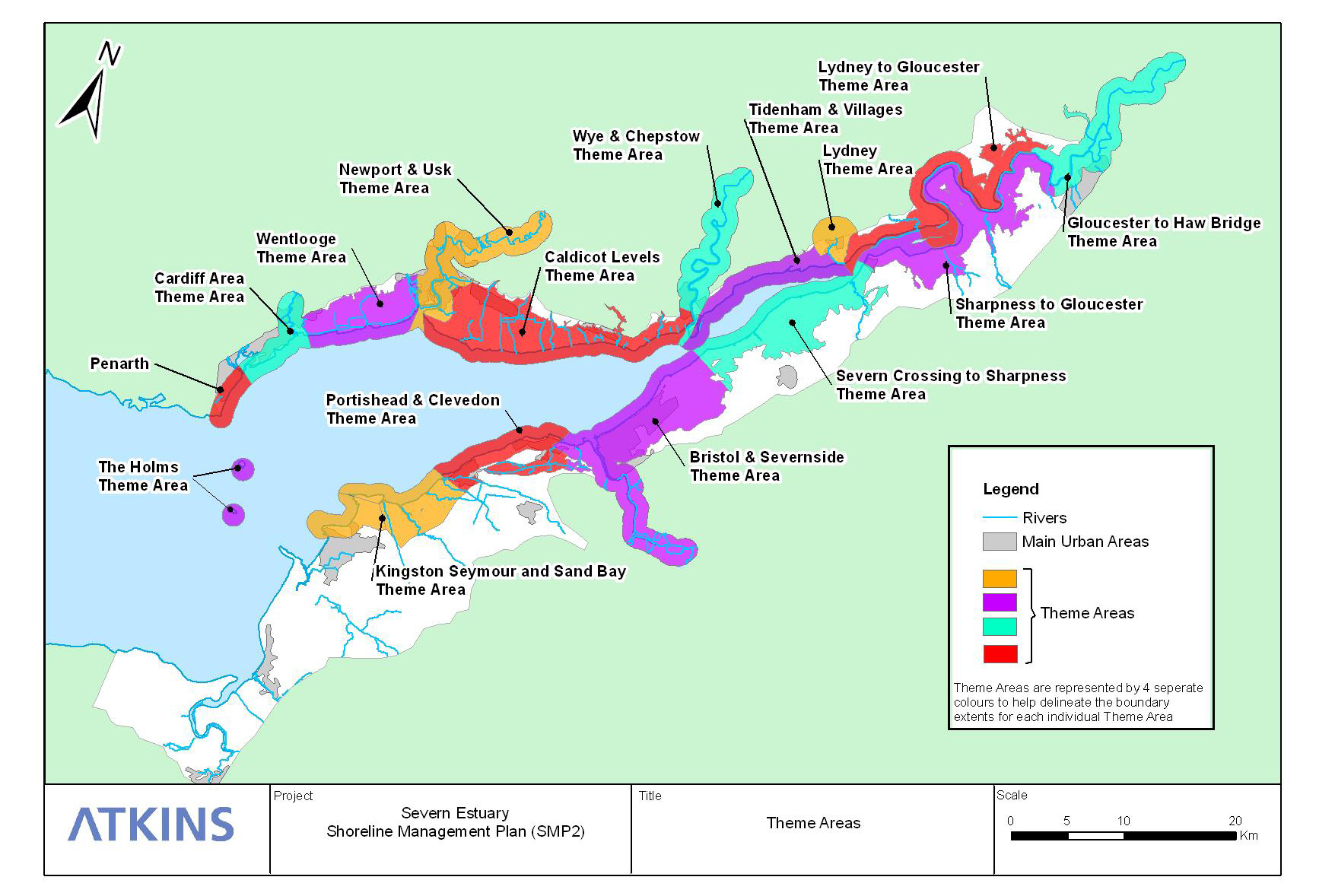
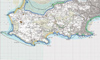
Severn Estuary Coastal Group
 Map showing the area covered by the Severn Estuaries Coastal Group
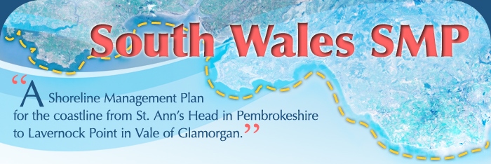
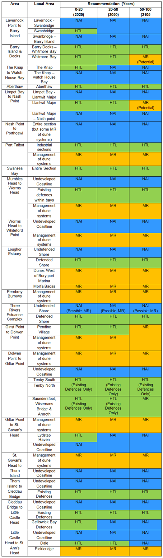
South Wales S.M.P.
West Wales S.M.P.
North Wales S.M.P.
Defra (2006). Shoreline Management Plan Guidance. March 2006.
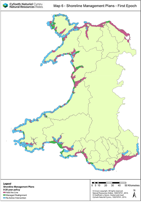
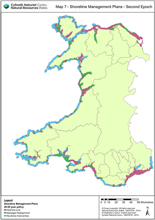
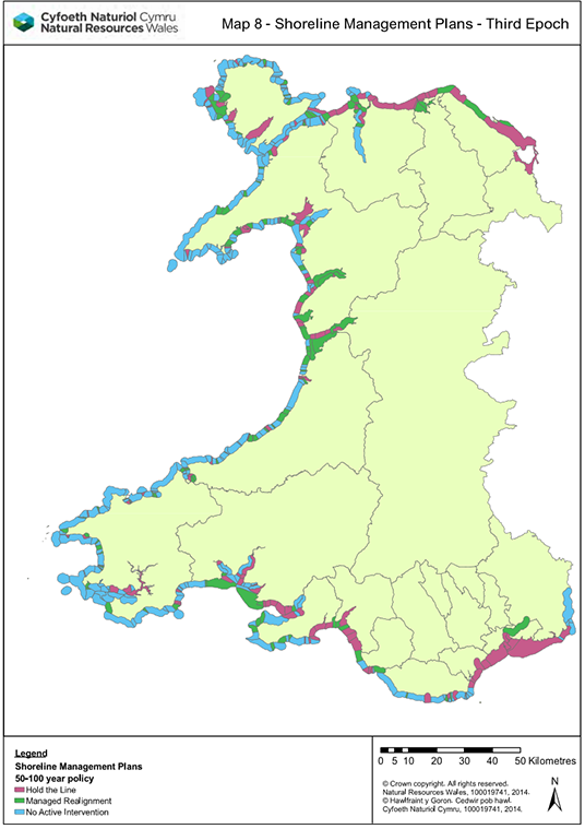
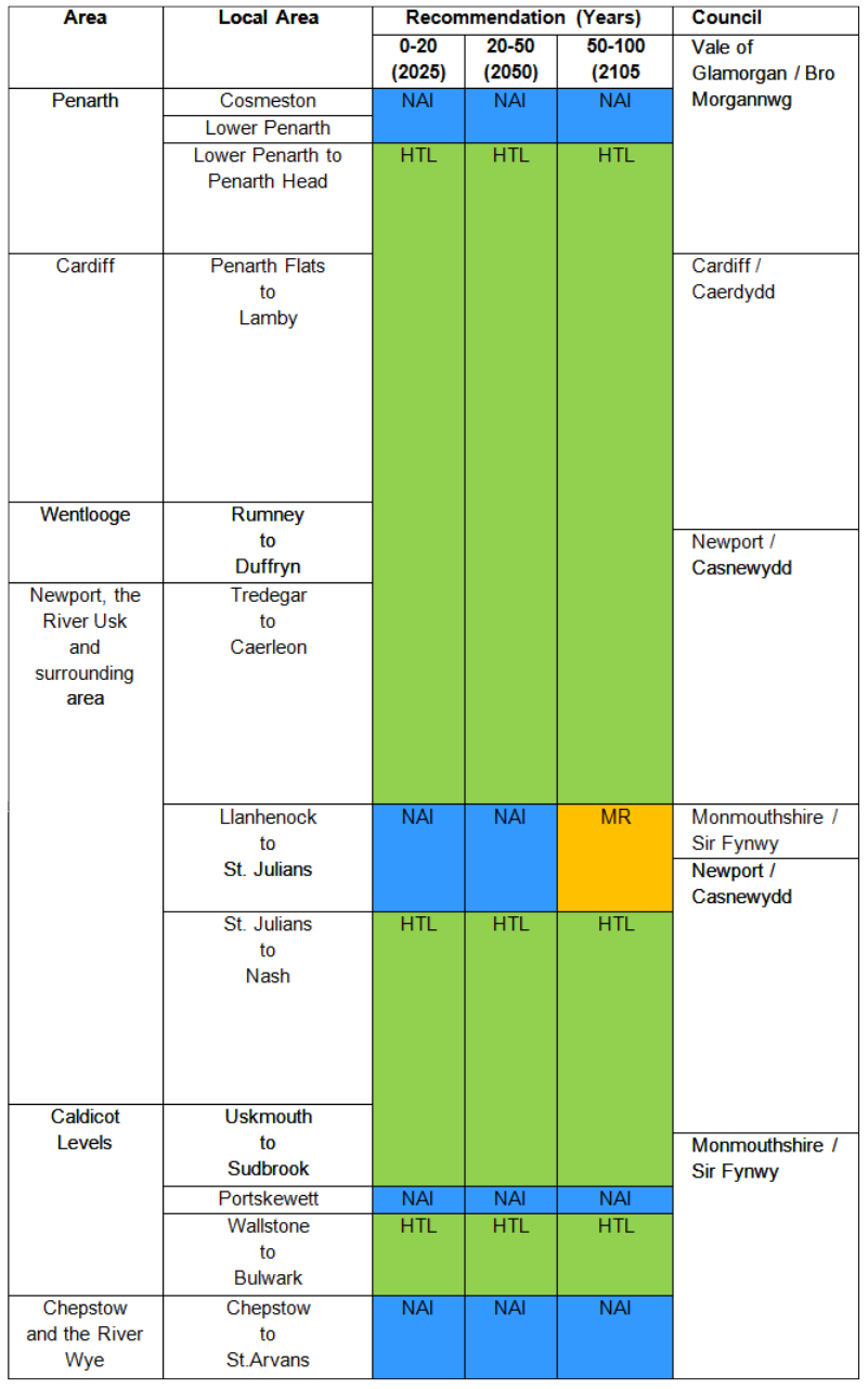
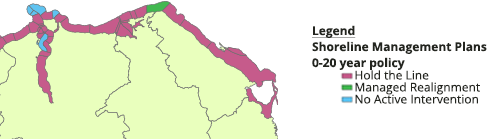
Proposals for the management of the Coastlines in Wales.
Epoch 1
0-20 years
(2025)
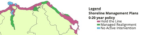
Epoch 2
20-50 years
(2050)
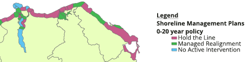
Epoch 3
50-100 years
(2105)
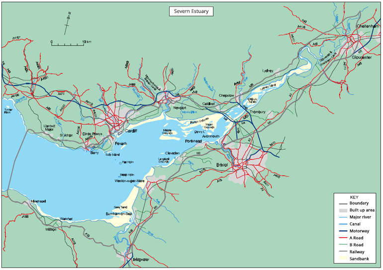
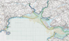
The Severn Estuary
In terms of length the Severn Estuary S.M.P. covers a relatively short section of our coastline.
However:
- In terms of population it covers major cities such as Cardiff & Newport.
- Major infrastructure such as the railway and motorway routes from West & South Wales to England.
- A large area of industry and other economic activities. In terms of the economic resources of Wales this section of coastline is the most important.
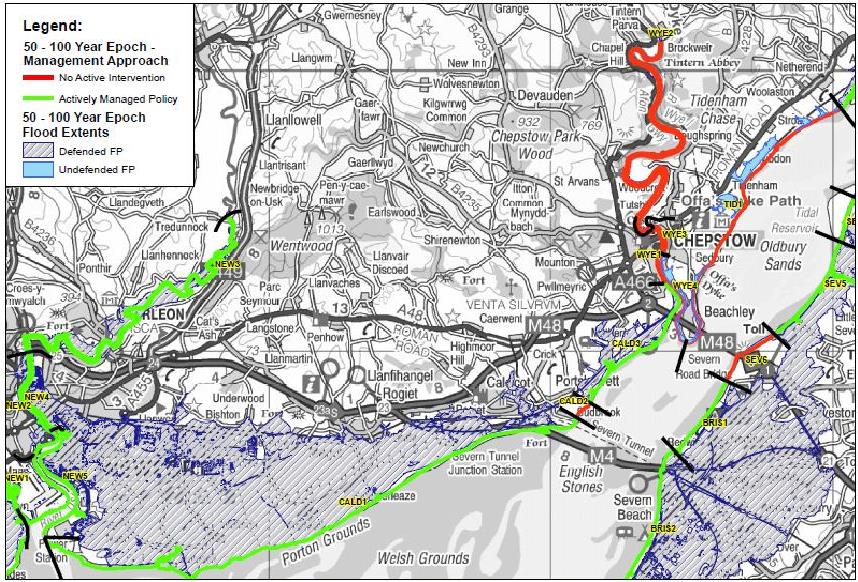
Map of River Wye
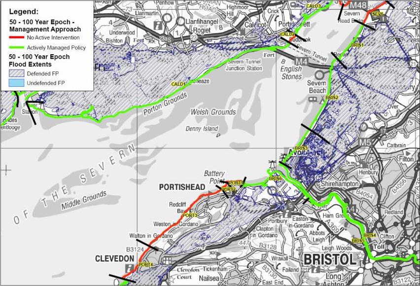
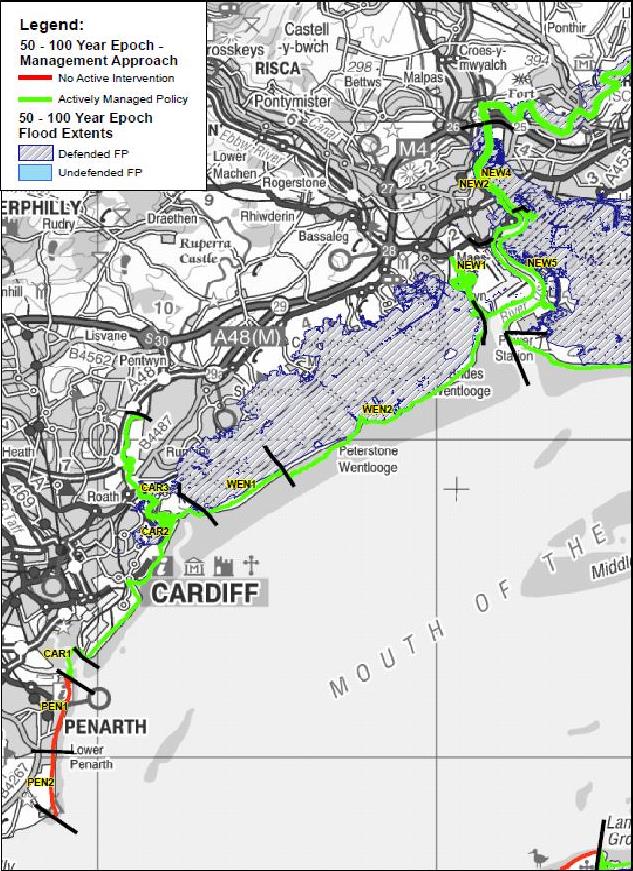
Map of Newport
Map of Penarth
Download Flyer PDF
The three maps show how the shoreline would look between 50 and 100 years from now if the choices being proposed were followed.
The maps show which stretches of the shoreline would be:
- Actively managed (by either Hold the Line, Advance the Line or Managed Realignment).
- Would not be actively managed (No Active Intervention).
Hotspots on the coastal outline map divided into the following sections:
Download Glamorgan Coastline PDF

Download Swansea Bay PDF
Download Carmarthen Bay PDF
Download Pembrokeshire Coastline PDF
Download South Wales Summary Leaflet PDF
Detailed Table
Management of Sand Dunes will result in Managed Retreat (MR)
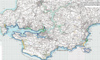
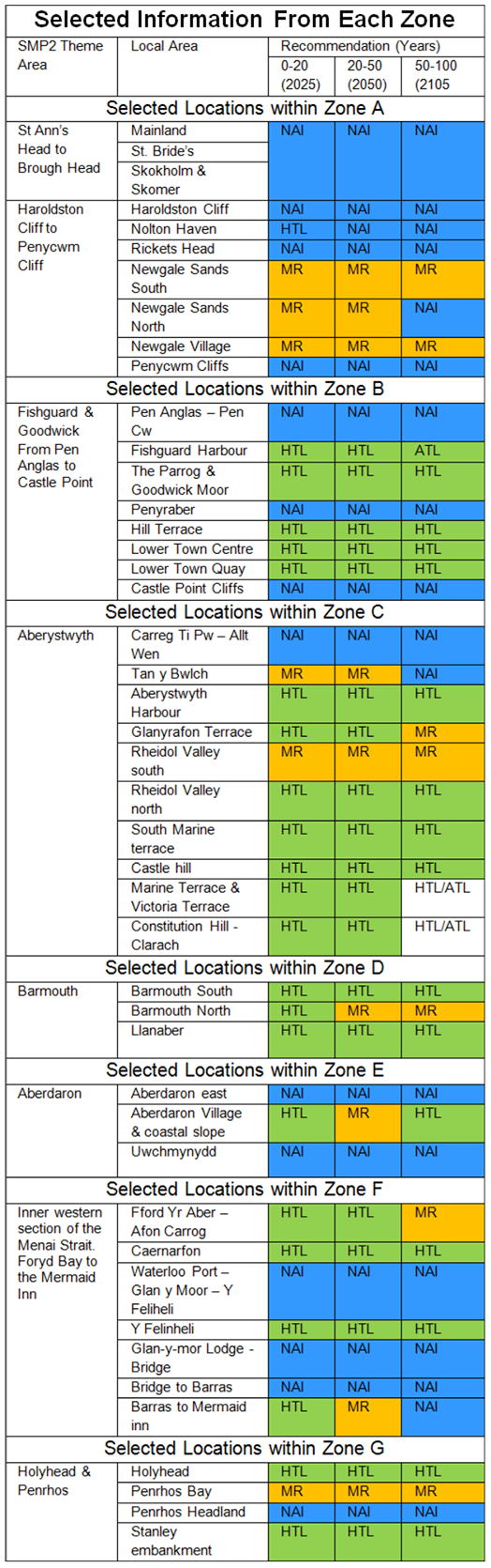
West Wales (and most of North Wales)
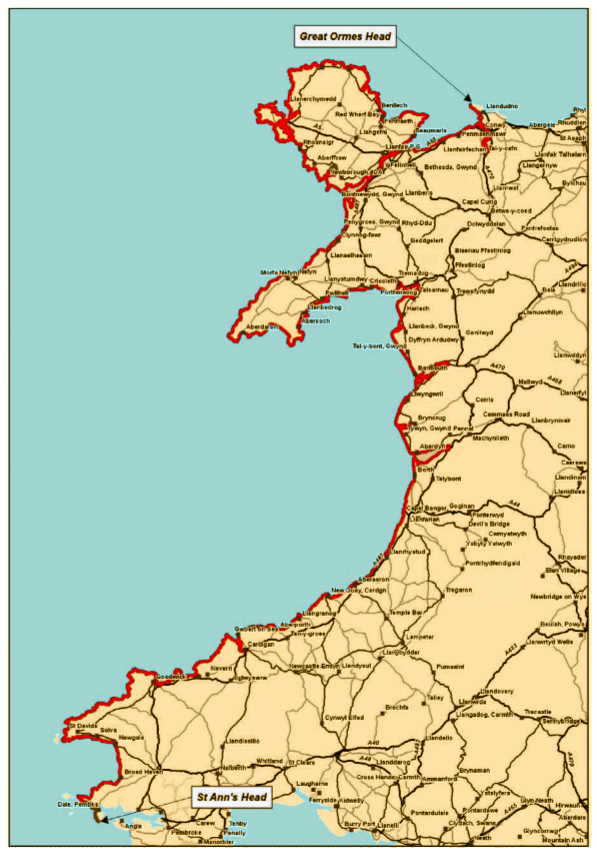
From St. Ann’s Head to the Great Orme in Conwy
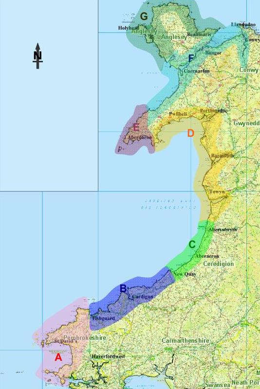
A) West Pembrokeshire
B) Cardigan
C) Central Ceredigion
D) North Cardigan Bay
E) West Llŷn
F) Menai and Conwy
G) North Anglesey
The West Wales S.M.P. does not use maps in the same way so it is useful to look again at the N.R.W. maps used earlier.
Epoch 1
Epoch 2
Epoch 3
North Wales
The North Wales S.M.P. area is linked to all of the North-West of England; as a result it is does not have as much information as the other three areas.
As such the best current information is from the N.R.W. maps used previously:
Epoch 1
Epoch 2
Epoch 3
Student Activity
Try to write a list with 10 reasons why you think coastal flooding might be getting worse.
Extension Activity
Try to explain why each of your 10 reasons might make coastal flooding worse.
Decision Making Exercise
Imagine you have been given a job in the Wales Coastal Monitoring Centre – W.C.M.C.
You will be asked to write a brief report about a part of the coast in Wales.
You will need to:
- Write some information about the coastal floods in 2013 and 2014.
- Use some of the information from the main article to say why floods might get worse along our coastlines.
- What do the following terms mean:
- No Active Intervention (N.A.I.)
- Hold the Line (H.T.L.)
- Managed Realignment (M.R.)
- Advance the Line (A.T.L.)
- Use maps to help you to show what has been planned for a place along our coastline in the following time periods:
- Epoch 1 (short-term) = years 0 to 20
- Epoch 2 (medium term) = years 20 to 50 and
- Epoch 3 (long term) = years 50 to 100
- Your Decision:
- Either justify why you think this is the best option or
- Provide an alternative plan and justify why you have changed it.
- Extension
- Choose more locations to explore different options of managing our coast against future floods.