Different Types Of Volcanoes
In the main article we started to look at the different types of volcanoes but there are some other key terms we need to know:
- Active Volcanoes – scientists can never decide on a single definition but the most widely accepted description of an active volcano is if has erupted or shows sign of activity such as tremors or gas emissions within recorded history (past 2,000 years or so).
- Extinct Volcanoes – again scientists cannot agree but if a volcano no longer has a magma supply then it is viewed that it will not erupt again and is termed extinct.
- Dormant Volcanoes – again scientists cannot agree but volcanoes that have not erupted with recorded history but do still have a magma supply so could erupt again are usually termed dormant. Some volcano magma chambers have a very long time to recharge (fill up); Yellowstone in The USA is around 700,000 years.
Scientists are sometimes surprised when a volcano believed to be extinct suddenly comes back to life such as the Soufrière Hills Volcano on the British Overseas Territory of Montserrat which suddenly became active again in 1995.
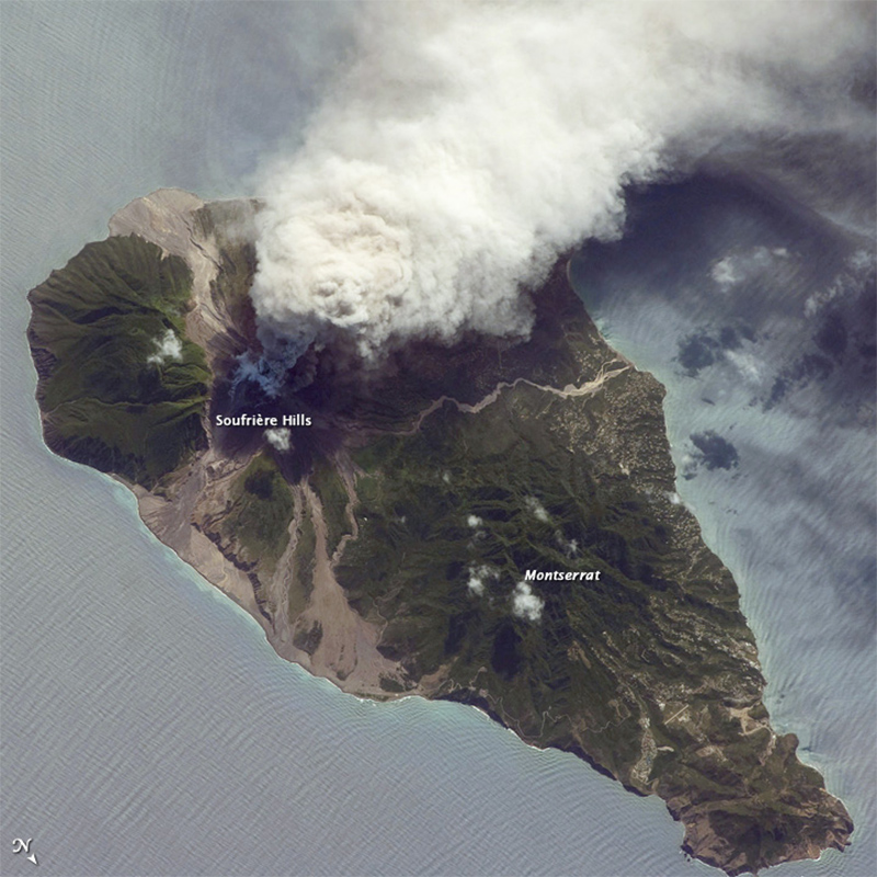
Image: Soufrière 2009 eruption - NASA International Space Station, Expedition 21 crew / NASA © Public Domain
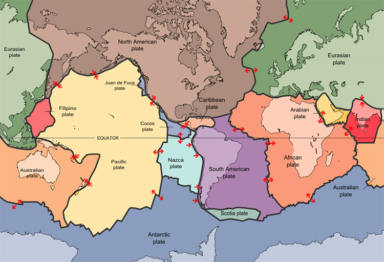
Image: Plates tect2 en - USGS © Public Domain
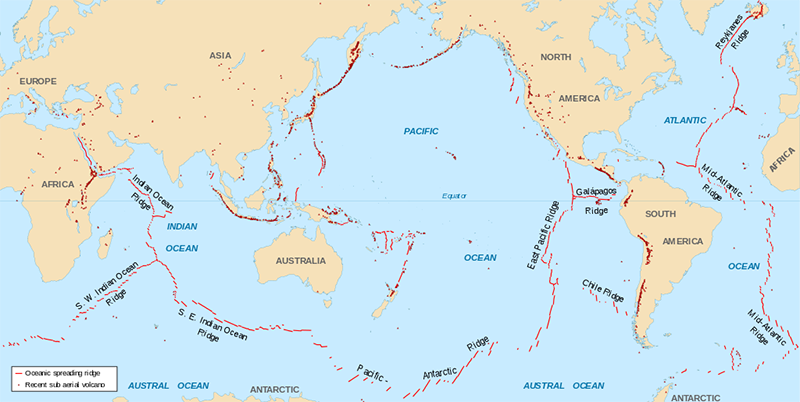
Image: Spreading ridges volcanoes map-en - Eric Gaba (Sting) © Public Domain
Compare the map of active volcanoes above to this topographical map.
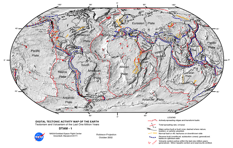
Image: Plate tectonics map - Michael Metzger / NASA © Public Domain
Many of the world’s most active and dangerous volcanoes are at the subduction zones that mostly line the edges of the pacific plate.
The edges of the pacific plate is sometimes called the ‘Ring of Fire’ and the majority of the most dangerous areas for Volcanoes in the world are along the ring of fire and in particular the region making up Indonesia.
Ring of Fire
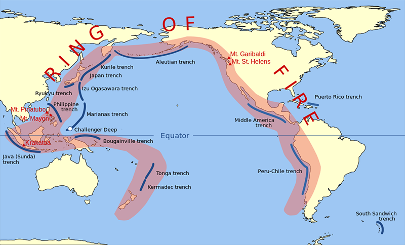
Image: Pacific Ring of Fire - Gringer © Public Domain
Indonesia
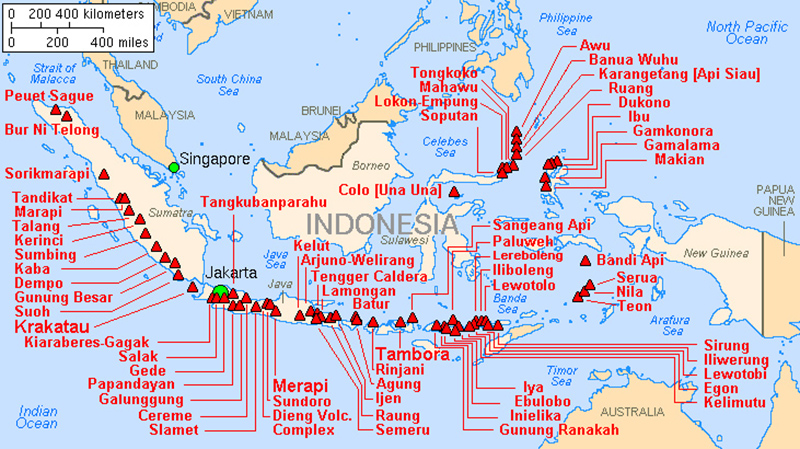
Image: Map indonesia volcanoes - Lyn Topinka / USGS © Public Domain
On the map above:
- Find the famous volcano Krakatau (Krakatoa).
- How many active volcanoes are there?
Mount Rinjani 1994 Lombok Indonesia
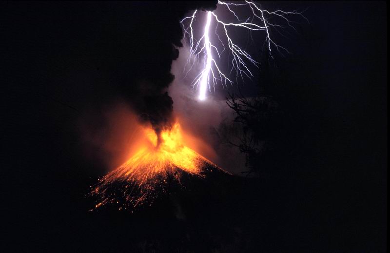
Image: Rinjani 1994 - Oliver Spalt © Wikimedia Commons under Creative Commons Attribution-Share Alike 3.0 Unported
Volcanic Hazards
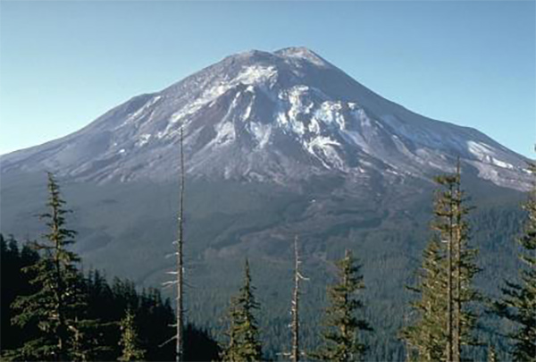
Blast where magma is viscous gas cannot escape and builds up eventually causing an explosion. If this is vertical it does not cause much damage but occasionally the blast is latteral (out of the side of the volcano) and this can flatten forests or anything else in its path for many kilometres. This happened in the eruption of Mt St Helens USA in 1980.
Before
After
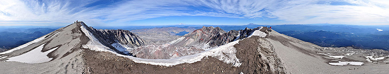
Image: Mount St Helens Summit Pano II - Gregg M. Erickson © Wikimedia Commons under Creative Commons Attribution-Share Alike 3.0 Unported
Ash Cloud when a blast is vertical it blows fragments of rocks rapidly cooled lava as ash several kilometres into the atmosphere. Winds can carry this ash many kilometres before it falls burying buildings or being breathed in.
Volcanic Bombs are the larger rocks blown upwards by the blast these land closer to the volcano.
Pyroclastic surges (flows) happen when the upwards thrust of the explosion can no longer support the hot gas, ash and rocks above within the column. The column collapses downwards and then flows down the sides of the volcano as a superheated (typically above 400˚c) cloud of gas and ash.
City of St Pierre destroyed by a pyroclastic flow in 1902. There was only 1 recorded survivor who was a prisoner in a dungeon.
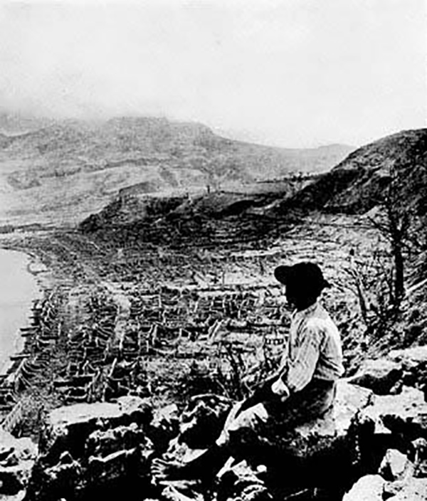
Image: Pelee 1902 3 - RGM~commonswiki © Public Domain {{PD-US}}
Lahars happen when ash combines with heavy rainfall (often a volcanic eruption triggers heavy thunderstorms) or melting snow and ice to create rivers of thick mud and rocks which can level forests and buildings and then set hard like concrete.
Lahar before and after – Mt Pinatubo
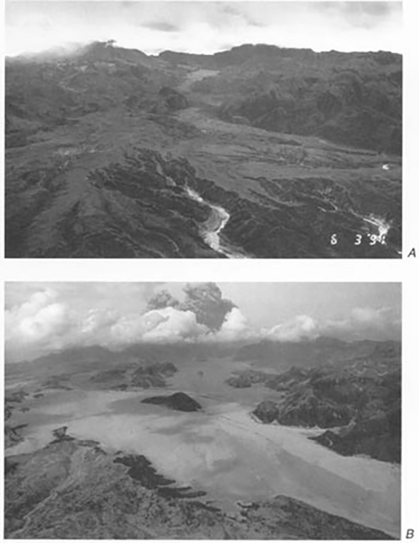
Image: River valley filled in by pyroclastic flows, Mt. Pinatubo - Magalhães © Public Domain
A flank collapse is where the side of a volcano breaks off like a giant landslide. This happened in the 1980 eruption of Mt St Helens which is why the blast was lateral instead of vertical. If a flank collapse happens on a volcanic island then the resultant landslide can cause a giant wave or tsunami. There is evidence that in the past flank collapses in the Canary Islands have created tsunami above 100 metres in height termed megatsunami; these could destroy everything along the Atlantic Coastline. The collapse of the volcano Krakatau (Krakatoa) in Indonesia in 1883 killed 36,000 people (some experts believed it could have been as many as 120,000) mostly by the huge tsunami’s caused as the volcano collapsed.
Lava flows are not really too dangerous to people (unless they are very foolish or very unlucky) as in explosive volcanoes the viscous lava moves too slow to be dangerous for people. Fluid lava forms lava fountains and can travel in rivers faster than most people can run but at these speeds it is within known channels. Fluid lava is mostly of danger to property.
Fluid Lava fountain Kiauea
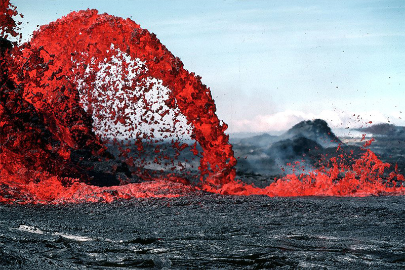
Image: Pahoeoe fountain original - Jim D. Griggs, HVO (USGS) staff photographer / USGS © Public Domain
Climate Change can occur as gas such as Sulphur Dioxide causes cooling while ash and dust can increase scattering and reflection of incoming heat from the sun. After the Krakatau eruption in 1883 global temperatures took five years to return back to normal and in 1884 there were serious food shortages nearly everywhere.
Pupil Activity
As a group research and write a script to give a presentation on one of the slideshows of a famous volcano/eruption below.
Mount St Helens
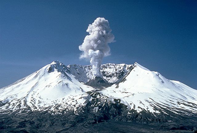
Image: MSH82 st helens plume from harrys ridge 05-19-82 - Lyn Topinka / USGS © Public Domain
Krakatau
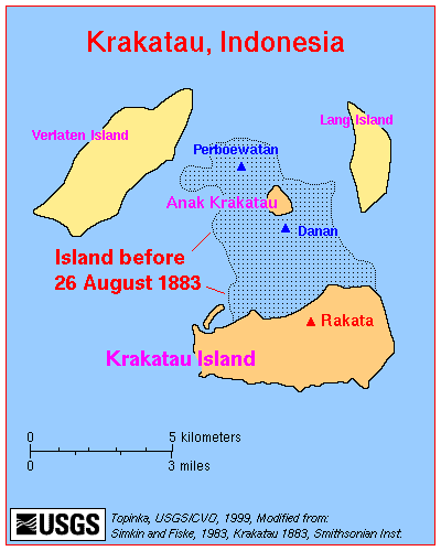
Image: Map krakatau - USGS © Public Domain
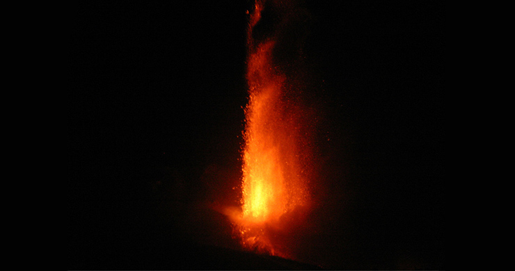
Mount Etna Italy
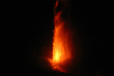
Image: 04Sep2007 Etna from SE Crater - Jason Bott, Christopher Berger, Pete Garza © Wikimedia Commons under Creative Commons Attribution-Share Alike 3.0 Unported
Mount Pinatubo - The Philippines
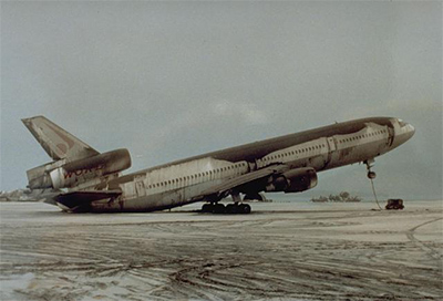
Image: DC-10-30 resting on its tail due to Pinatubo ashfall - R.L. Rieger / U.S. Geological Survey © Public Domain
Mont Pelee - Martinique
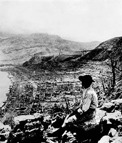
Image: Pelee 1902 3 - RGM~commonswiki © Public Domain {{PD-US}}
Mount Vesuvius
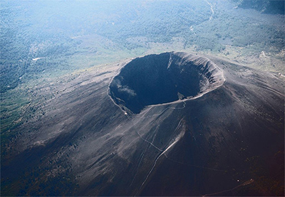
Image: Vesuvius from plane - Pastorius © Wikimedia Commons under Creative Commons Attribution-Share Alike 3.0 Unported