Plate Tectonics Overview
Plate Tectonic Model Overview
In the main article of this edition we finished by looking at this map.
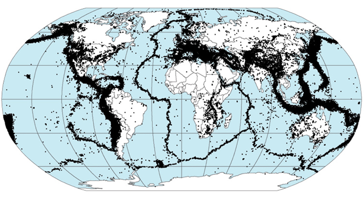
Image: Quake epicenters 1963-98 - NASA, DTAM project team © Public Domain
Using maps like these of earthquakes, volcanoes as well as what we see on the land and by surveying beneath the oceans scientists developed a model to help explain what is happening.
This model is called the Plate Tectonic Model.
The model divides the cooler rigid upper layers of the earth into pieces called tectonic plates. Over time these move and this helps to explain where most of the powerful earthquakes occur and also most of the volcanoes.
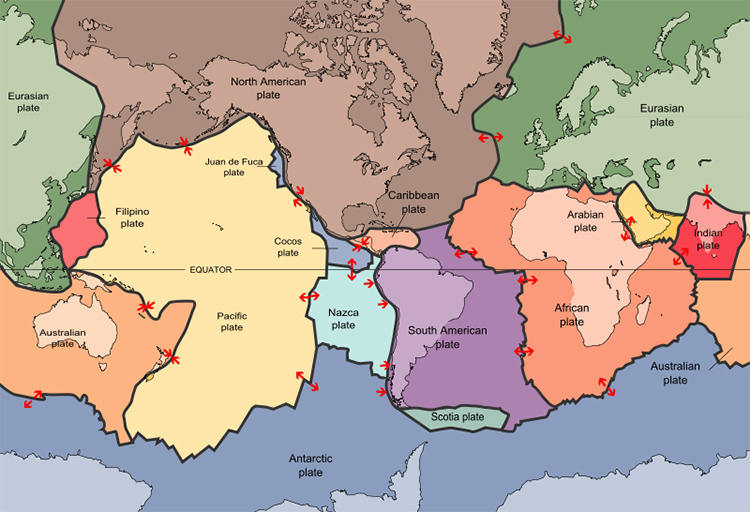
Image: Plates tect2 en - USGS © Public Domain
The main tectonic plates can be seen on the map above like pieces of a jigsaw.
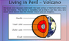
Danger Volcano! KS3 Link - Click below
Italy & the surrounding tectonic plates
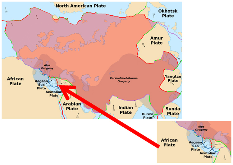
Image: EurasianPlate - Alataristarion © Wikimedia Commons under Creative Commons Attribution-Share Alike 4.0 International
The African Plate is moving Northwards into the Eurasian Plate
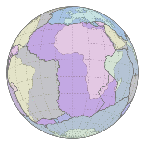
Image: Motion of Nubia Plate - Rollingfrenzy © Wikimedia Commons under Creative Commons Attribution-Share Alike 4.0 International
Italy is sandwiched between the main huge African Plate (and the Adriatic ‘Micro-Plate (which broke off the African Plate)) and the large Eurasian Plate.
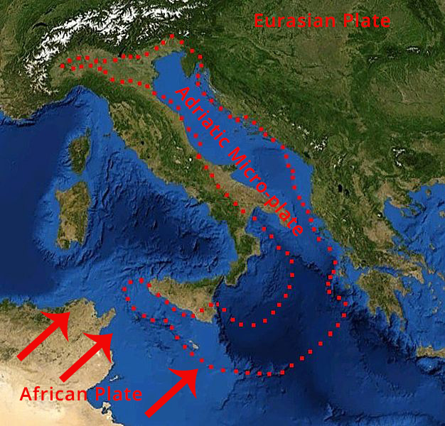
Image: Adriatic Plate - Eric Gaba (Sting) / NASA © Public Domain
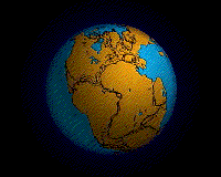
The Tectonic Plates have been moving for millions of years since a giant ‘super-continent’ called Pangaea started breaking up 200-180 million years ago.
The tectonic plates are made up of cooler rigid rocks of the crust and upper mantle. This rigid layer is called the Lithosphere by scientists.
Below the lithosphere the lower mantle rocks are hot enough that they can flow.
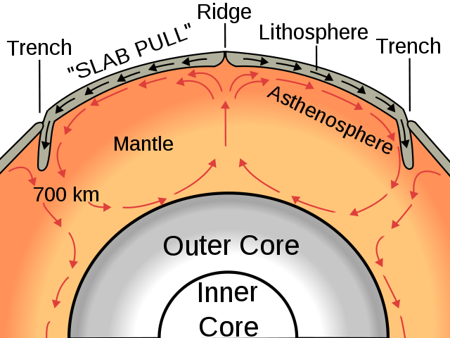
Image: Oceanic spreading - Surachit © Wikimedia Commons under Creative Commons Attribution-Share Alike 3.0 Unported
Try to think of these two layers as toffee; the rigid layer is like toffee in the fridge hard enough to break your teeth but if you stick somewhere warm for a few hours it becomes soft.
The centre of the Earth is very hot and this heat moves outwards to the surface; one way that it does this is in giant convection (warm things rise and cooler things sink) currents in the softer mantle rocks.
These currents in the mantle pull the Tectonic Plates above them.
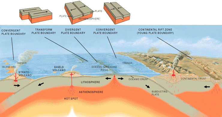
Where they meet we have different types of boundaries and these lead to different types of volcanoes, earthquakes and landforms.
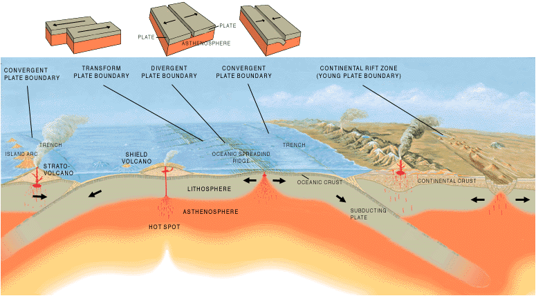
Image: Tectonic plate boundaries - Jose F. Vigil. USGS © Public Domain
Pupil Activity
Use a mind map type of diagram to show the main points of the Plate Tectonics Model.