Tectonic Mayhem
2010 has been a very eventful year for earthquakes and volcanoes.
January (earthquake)
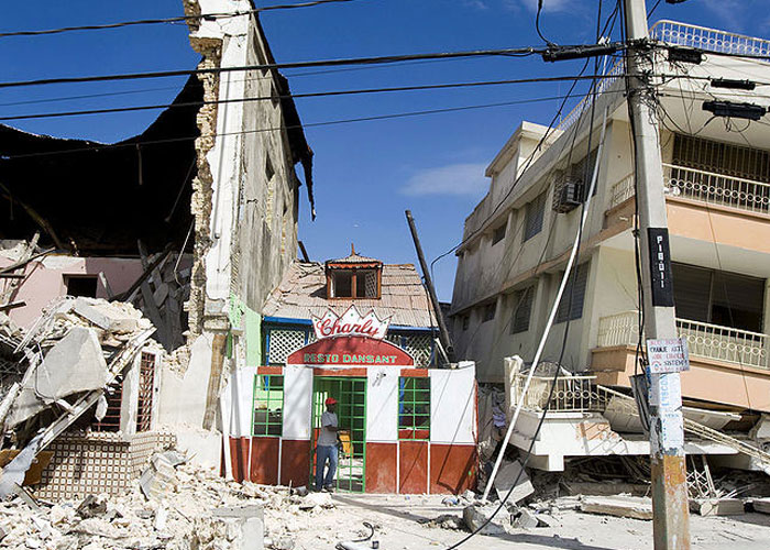
Haiti: over 230,000 people were killed and over 1 million were injured when a 7- magnitude earthquake struck.
February (earthquake)
Chile: about 452 people were killed when an 8.8- magnitude earthquake struck.
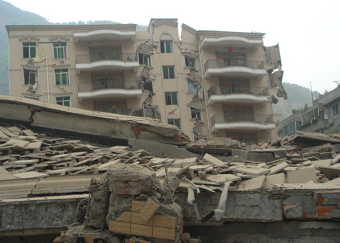
April (earthquake)
China: at least 400 people died after a 6.9 - magnitude earthquake struck western China's Qinghai province.
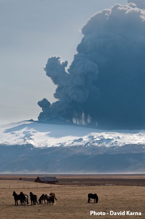
April – May (volcano)
Iceland: all flights to and from the United Kingdom were stopped because of volcanic ash coming from a volcano in Iceland.
Did you know?
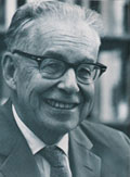
The size of an earthquake most often described on the news is measured using a scale invented by Charles Richter who was an American scientist. The Richter scale goes from the weakest (magnitude 1) to the strongest (magnitude 9).
| Description | Magnitude | Frequency per year |
| Great | 8.0+ | 1 |
| Major | 7.0-7.9 | 18 |
| Large (destructive) | 6.0-6.9 | 120 |
| Moderate (damaging) | 5.0-5.9 | 1,000 |
| Minor (damage slight) | 4.0-4.0 | 6,000 |
| Generally felt | 3.0-3.9 | 49,000 |
| Potentially perceptible | 2.0-2.9 | 300,000 |
| Imperceptible | less than 2.0 | 600,000+ |
Flash Player Required

What causes earthquakes and volcanoes?
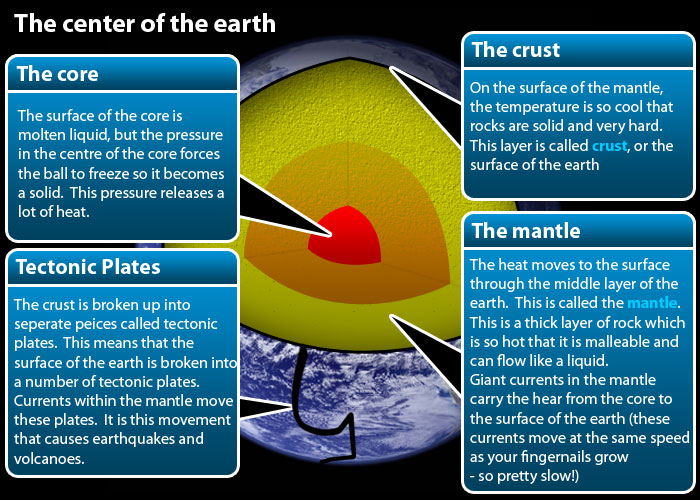
Nearly all major earthquakes and volcanoes happen near the edges of tectonic plates. Iceland is a place where two plates are moving apart. Haiti, Chile and China are places where plates have been forced into each other.
Earthquakes are waves of energy caused when the tectonic plates bump into each other. A break or fracture within a layer of rock is called a fault. The size of the area of rock that breaks and moves causes the strength of the resulting earthquake: the bigger the area of rock that breaks, the bigger the earthquake. For example, if an area of rock the size of Wales breaks and moves that would result in a magnitude 8 earthquake.
Did you know?

An earthquake is a shaking in the earth. A magnitude 1 earthquake is similar to the shaking produced when an average-sized man jumps from a 1 metre high table top onto the ground. Only sensitive instruments called seismometers can detect these. Each level of magnitude is 10 times bigger than the previous one.
Why did the Haiti earthquake kill more than the Chilean earthquake?
We already know that an earthquake happens when an area of rock within the earth breaks and moves along a fault. This point is called the earthquake focus. Waves of energy spread out in a circular pattern when they reach the surface (the point on the surface directly above the focus is called the epicentre). The waves then spread out across the surface just like ripples in a pond. It is these surface waves that cause the damage.
If the focus is close to the surface then more of the energy reaches the surface. The energy level drops as the waves travel through the rocks and as a result the waves get smaller. In Haiti the focus was very shallow – less than 15km so nearly all of the energy reached the surface.
Did you know?

The volcano that brought UK air travel to a stop is located at a point where two plates move apart. Beneath the surface a current in the mantle is rising towards the surface. As it rises the pressure drops and some of the minerals melt to produce a mixture of liquid rock (magma) and dissolved gas.
When this reaches the surface it is like a violently shaken bottle of pop that explodes when the lid is taken off. All the overlying rock and magma is pulverised into ash and thrown high into the atmosphere.
Unusual weather conditions (the usual wind direction (prevailing) is from the South West) carried the ash over the UK causing the chaos.
Geography
The next important point is population density. In Haiti the epicentre was very close to the capital city Port au Prince; as a result the earthquake affected a city of over 2 million people.
Human geography
The final factor is wealth; Haiti is much poorer than the other countries so most buildings were not lifesafe. Lifesafe buildings have reinforced corners where columns, walls and floors meet.
Lifesafe buildings do not collapse or flatten but they require 10 per cent more materials to build and are 10-15 per cent more expensive to build. After the earthquake Haiti did not have the emergency services to cope so many more people were killed. These are an example of how human geography made a physical geography disaster even worse.
So ultimately the danger from an earthquake is not so much a case of how big it is but where it happens - the most dangerous earthquakes happen close to:
-
The surface
-
Areas of high population density (cities)
-
Poor countries
Tasks:
Produce a news report on what happened and why it happened. Include details of both the physical geographical reasons and human reasons for the disaster.
Think about this – imagine trying to draw a graph to show the levels of magnitude.
Level one could be shown as a bar 1mm high, level 2 would be 10mm (1cm), level 3 would be 10cm, level 4 would be 100cm (1 metre (m), level 5 would be 10m, level 6 would be 100m, level 7 1000m (1km), level 8 would be 10km & level 9 would be 100km! How many pieces of graph paper would you need to draw that graph?