Coastline news
After five long years of hard work the Wales Coast Path had its big launch in May 2012; for the rest of the year communities all along the coastline of Wales are planning events to mark this world first achievement. The 870 miles of the coast path will eventually link with the Offa's Dyke Path National Trail to create a 1030 mile continuous walking route around the whole of Wales.
Since 2007, the Welsh Government has been investing in improving public access to the Welsh coast through its Coastal Access Improvement Programme (CAIP).
The Wales Coast Path has been developed by the Welsh Government in partnership with the Countryside Council for Wales, sixteen local authorities and two National Parks. The Welsh Government and the coastal local authorities of have spent approximately £2 million per year; the European Regional Development Fund has also provided nearly £4 million in support of the project.
Did you know?
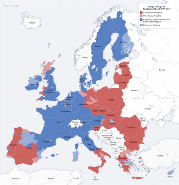
The West Wales and the Valleys have been awarded the highest level of support known as Convergence, from the European Union between 2007 and 2013. Convergence is about making the lives and opportunities of all people in the EU more equal or allowing them to converge in standards. Convergence status covers 15 local authority areas in the West Wales and the Valleys regions.
The Convergence programmes for West Wales and the Valleys comprise funding from two separate European Funds: the European Regional Development Fund (ERDF) and the European Social Fund (ESF). Between 2007 and 2013 around £1 billion of ERDF funds will help the region's transformation into a sustainable and competitive economy. Over £690 million from the ESF will also be used to tackle economic inactivity, increase skills and employment. Together, with match funding, Convergence will drive a total investment of £3.5 billion in West Wales and the Valleys.
Wales gets a lot from being part of the EU!
Improvements to the route will continue throughout 2012 and 2013 to ensure that the path follows the Welsh coastline as close as it is safe and practical. The idea was developed to try to build on the economic success of the Pembrokeshire Coast Path National Trail and the Isle of Anglesey Coastal Path - both of which are major contributors to the visitor economy of Wales.
 The whole path is designed to be accessible to walkers and where practical some sections will also be suitable for cyclists, families with pushchairs, people with restricted mobility and horse riders.
The Path has been split into eight geographical areas:
-
South Wales Coast & Severn Estuary
-
Gower & Swansea Bay
-
Carmarthenshire
-
Pembrokeshire
-
Ceredigion
-
Menai, Llŵn & Meirionnydd
-
Isle of Anglesey
-
North Wales Coast & Dee Estuary
The Southern Estuary Coastline
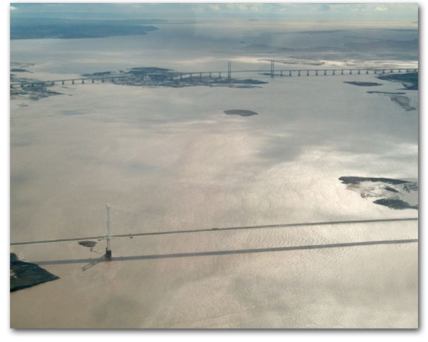
Starting in Chepstow on the border with England the path at first is dominated by estuary environments. At Chepstow the river Wye joins the Severn Estuary and the coastline is dominated by estuary mudflats. This section also includes the Severn Bridge and The Second Severn Crossing.
The Severn Estuary may not be the most spectacular section of the Wales Coast Path but it is one of the most special in terms of its importance to wildlife (especially birdlife) and also for its special Physical Geography as it has one of the biggest tidal ranges in the world. This means that as you walk along you could see water or nothing but mud.
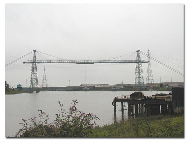
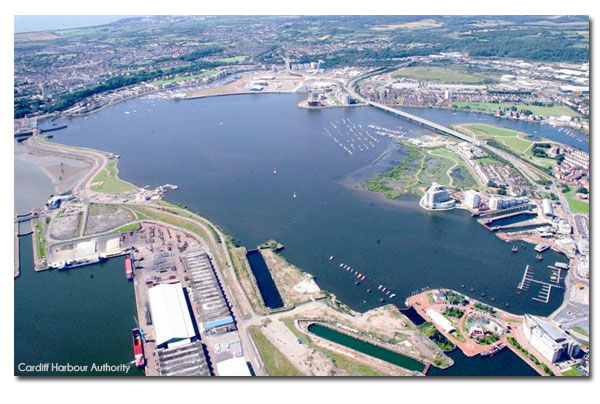
As the estuary widens it is known as the Bristol Channel and the path leads the walker through the city of Newport with its famous transporter bridge at the mouth of the River Usk and then onwards towards Cardiff and Cardiff Bay where the River Taff meets the sea.
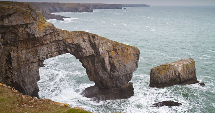
The Rocky Coasts of South and South West Wales
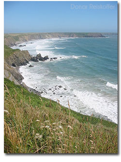
After Cardiff the character of the coastline changes dramatically from a flat estuarine environment to a coastline dominated by rocky cliffs broken up by occasional beaches and small river mouths. This section of the starts to face a greater amount of open sea/ocean towards the Southwest. This means that the sea has far more energy than it did in the sheltered estuary areas further East. There are also a lot more hard rocks underneath the ground which is why this area is so different.
A typical rocky location here is Southerndown where if you are lucky you might meet the BBC filming Doctor Who. This section of rocky coastline is broken by beaches in Bays where the rocks are less hard. The beaches of Porthcawl, Aberavon and Swansea Bay are all major stretches of sand along this section.
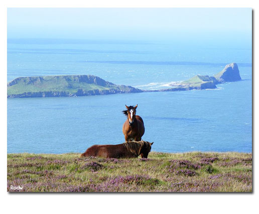
After Swansea Bay comes the Beautiful Gower Peninsular. The Gower Peninsular was the first Place in Britain to gain the legal status as An area of Outstanding Natural Beauty. It is dominated by rock cliffs and headlands broken by small beaches. North of Wormshead above however is the long beach of Rhossili followed by the Loughor Estuary.
At the head of the Loughor estuary is the town of Llanelli world famous for its rugby team and now as a growing centre for film and media. After the town of Llanelli is Cefn Sidan beach; one of the longest in Wales. The rocky section of the coast however ends in dramatic fashion in the Pembrokeshire Coast National Park.
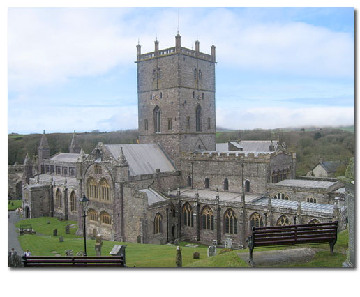
As well as the stunning physical environment the Pembrokeshire section is home to St Davids and it Cathedral. This small city grew around the birthplace and home of the Patron Saint of Wales who was born just south of the city in AD 500.
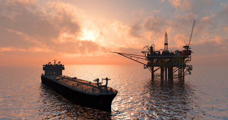
This section of coastline also holds the superb natural harbour of Milford Haven and its associated industry.
After Pembrokeshire the coastline of Wales again changes its character as the broad sweep of Cardigan Bay begins.
Cardigan Bay and West Wales
Northwards of Pembrokeshire the hard Geology becomes less common and the West coast of Wales is sheltered from the biggest ocean waves by Ireland to the West.
Though having some of most majestic beaches this section of coastline does have many rocky sections. Many readers will be familiar with Llangrannog which is the home of the residential centre which helps promote the welsh language. Or the small towns of Aberaeron or Newquay. The marine wildlife in the Bay especially the larger mammals such as dolphins and seals can be seen from the coast path itself.
 The main town on this section is Aberystwyth which is a famous university town and after this the path moves up to Machynlleth where walkers can visit the Centre for Alternative Technology.
The Centre for Alternative Technology centre in Powys which demonstrates and teaches sustainable development. CAT, despite its name also provides information on all aspects of sustainable living as well as supporting education programmes and local sustainable businesses.
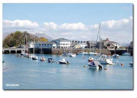
North of Machynlleth the coastline continues through beautiful beaches and small towns such as Barmouth. This section finally finishes in the thriving town of Porthmadog after which the character of the coastline dramatically changes again. Porthmadog harbour here was originally constructed to export slate and the town is also home to historic railways lines also used in the industry.
Llŷn Peninsular, Anglesey and the North Wales Coast
 The geology of the coastline changes dramatically after Porthmadog with hard volcanic rocks similar to those forming Snowdonia helping to form the Llŷn Peninsular. These hard rocks cause dramatic cliff landscapes but also as the peninsular is so long it also helped to keep large areas remote from the dilution of welsh culture. The area is now famous for its retention of both Welsh Language and culture which has also served to attract increased numbers of visitors putting that very language and culture under threat.
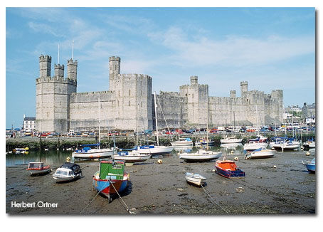
North of Llŷn is the historic town of Caernarfon with its castle. The castles in the North Wales region are a major historic tourist attraction and a highlight of the Wales Coast Path. After Caernarfon is the Menai Straight which separates Mainland Wales from Anglesey which along with Pembrokeshire was one of the two original Wales coastal paths. The island of Anglesey is adding to its historic and cultural attractions by becoming a world centre for the development of alternative energy supplies.
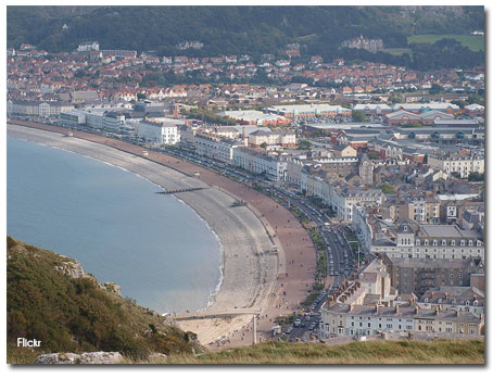 The North Wales coast is highly accessible to many of the major cities of North west England and as a result has some of the best developed towns in terms of both accommodation and attractions. These major centres include Llandudno, Rhyl and Prestatyn which is where the Coast Path joins the Offa's Dyke Path National Trail which would take the dedicated walker back to Chepstow in the South.
It is clear to see in the photograph of Llandudno how well developed its tourism infrastructure is.
Download an OS map from the Wales Coast Path website
Related links
Activity
-
Ideally choose a map of a place on the coast that you have visited if you have never visited a place on the Welsh Coast then choose any place you like.
-
Print the map
-
Annotate (writing on or near the map which is more detailed than just labels) the map by writing what a walker would see as they walked along this section.
-
Extension - use your map and the Wales Coast Path Website to complete a piece of extended writing on your chosen section. Perhaps you could illustrate it with photographs from the website gallery.