KS3: European citizens; KS2: Hurricane nightmare
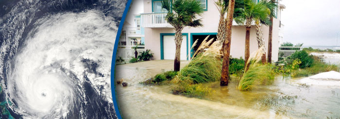
Hurricane Earl travelled along the coast of North Carolina, USA, in September this year. It continued to travel and some places had to declare a state of emergency because the damage the hurricane caused was so bad.
Hurricane Earl
What is a Hurricane?
Hurricanes can cause a lot of damage. They are caused by storms which begin over warm parts of the ocean. They begin to form a spiral when strong winds blow in opposite directions. These winds can reach up to 320km/h (200 hundred miles per hour). Most hurricanes form at sea and some never reach land.
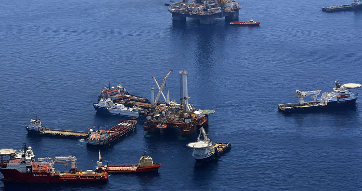
The winds and spiral are strong enough to destroy houses and sweep up cars and trucks. They create huge waves at sea which can also destroy boats and harbours.
Why call it Hurricane Earl?
Each season when the first hurricane is spotted it is given a name beginning with the letter ‘A’, the next hurricane is given a name beginning with ‘B’ and so on. Now we are up to ‘E’ which has been named Hurricane Earl!
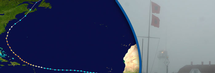
The path of Hurricane Earl
Did you know?
Our Sat Navs work out their position by using a network of over 30 'geostationary' American satellites that transmit extremely accurate 'atomic clock' time signals. But some of these satellites are quite old and may actually stop working soon.
At least 24 satellites are needed to give full Global Positioning System (GPS) coverage. The possibility of failures and blackouts will become greater as time goes. To make things worse, there have been delays in launching new satellites to replace the old ones. It has taken three years for some replacement satellites to be launched!
The American GPS system is no longer on its own. Russia, China and India each have their own expanding systems. The EU is also planning its own GPS system called Galileo. The work to build the first 14 satellites began in January 2010.
Hurricane Earl
The hurricane caused so much damage that a state of emergency was declared in North Carolina, South East Virginia, Massachusetts and Maryland.
What does a state of emergency mean?
This means that people prepared themsleves to cope with a natural disaster and soldiers were ready to be sent into the affected areas to help people caught in the storm.
What does storm damage mean?
This means that:
Areas of land become flooded, so people have to leave their homes and look for shelter somewhere else
Gusty winds pull down electricty cables
Roads are flooded and get blocked with fallen trees
Why did Hurricane Earl cause so many problems for holiday makers
In the United States they have a national holiday called Labour Day. On this day, thousands of people go to the coasts to enjoy the sunshine. This year, holiday makers had their holiday spoilt by the hurricane as many people had to be evacuated from the coast for their own safety.
Hurricane Earl continued out to sea as the inhabitants of the eastern American coast began to recover from the effects of the storm.
Did you know?
Maps are a way of showing places and the distances between them. They are used in all the languages of the world. But who began mapmaking?
A 25,000 year old rock etching in the Czech Republic is thought to be an early map of local mountains, rivers, valleys and routes. There are also cave paintings in France of simple star maps that are about 18,000 years old.
About 4,000 years ago, the Egyptians marked the outlines of their land. Their kings marked the boundaries of their kingdom on maps that were sometimes modelled out of clay. Around the same time, Greek mathematicians accurately worked out the distance around the Earth.